Tuesday, August 26, 2014

Sunday, 24 August, Mom and I sucessfully climbed and summitted Baxter Peak, Mt. Katahdin, ME, the northern terminus of the Appalachian Trail and began our trek south to complete the AT. The climb up to and back down Baxter Peak (total 10.4 miles) was by far the most difficult thing either of us have ever done in our lives, and it took us 15 hours to complete...but we did it. 


My former Battalion Command Sergeant Major, Sam Cushing and his wife Cathy accompanied us on our trek up Katahdin. It was quite the epic adventure and I will elaborate more when I have some time.


Here are some links to youtube videos of the AT trail up Mt Katahdin, the Hunt trail, and the insane climb and descent we completed.

 Video of Hunt/AT trail up Katahdin

AT Trail up Katahdin 


We are not finished, we are flip-flopping. We came up to Maine and will hike south to Virginia to finish the north half of the trail. We did this so that we wouldn't get shut out of Maine and New Hampshire by winter weather. We should finish in Virginia by Thanksgiving!!! Still trudging!!!

Saturday, August 23, 2014

Beginning our trip South!!!

We have enjoyed our few days off here in Scarborough, ME at my friend's house.  He and his wife have been amazing and we are refreshed, motivated and excited to continue on our adventure down the trail.  Mom couldn't deal with her big bulky backpack anymore, luckily, Hyperlight Mountain Gear is located just down the road from Scarborough in Biddeford, ME and we were able to get mom a new ultra-light backpack.  An unexpected expense, but well worth mom not feeling so weighed down.

We had the chance to visit Portland Head Light Lighthouse...


And a local chocolatier that has a lifesize moose made out of chocolate


Tomorrow, Saturday 23 Aug, we head up to Baxter State Park, Maine.  Sunday 24 Aug we hike up Mt. Katahdin and begin heading south to finish the trail.  Thanks to everyone for your support so far and keep it up, we are on on our way to finish!!!!!

www.gofundme.com/postwarhike

Monday, August 18, 2014

Completed 800 Miles!!! Heading to Maine

So we successfully passed the 800 mile mark yesterday and made it safely into Buena Vista, VA.  We have been able to arrange transportation up to Maine, so we are headed north to begin hiking south.  We are doing this because the weather up north will turn nasty soon.  So, if we continue heading north we could be closed out and not be able to finish due to weather.  Therefore, while the weather is good we will head up and hike south to finish.  We will summit Mt. Katahdin on Sunday 24 August is anyone wants to join us.  I know this is short notice and I apologize, but the offer still stands.

Thank you to everyone who has donated money so far to help us in our endeavor.  We are still in need of funds in order to continue hiking past September, so please feel free to pass on this website and our fundraising site, www.gofundme.com/postwarhike, to one and all.  Every little bit helps!!
Looking back down on the James river as we hiked up Big Rocky Row Mountain, a 2,312 ft climb up

A closer-up look at the James River foot bridge we crossed a few days earlier, while hiking up Big Rocky Row Mountain.

Brown Mountain Creek, 800 Miles!!!  And whoever says Virginia isn't rocky and is flat and fast is lying

Brown Mountain Creek Swimming hole 

Hendo's Mom and Hendo we just hiked 800 miles, what have you done lately!?!?!

Wednesday, August 13, 2014

Day 142- 151, 4 Aug - 13 Aug...Natural Bridge AT Club Rocks!!!!!!!


NATURAL BRIDGE APPALACHIAN TRAIL CLUB IS AWESOME!!!!!!!


In case anyone was wondering, we love the Natural Bridge Appalachian Trail Club.  We have been disappointed with the Roanoke AT Club, but the Natural Bridge Club has earned our accolades.  The AT is maintained by volunteers from various Clubs along the trail, with each club being responsible for a specific section of the trail.  The section of the trail the Roanoke AT Club maintains was terrible, meaning that it wasn't maintained, meaning that the trail was overgrown, downed trees and limbs had not been removed and rock work or steps, etc. were washed out or not installed.  The only part of the Roanoke AT Club trail that was properly maintained was the section from Daleville, VA to just south of Blackhorse Gap where Natural Bridge take over.  Whoever maintains that section does an amazing job and needs to teach the rest of the Roanoke Club how to maintain trail.  

Since we have entered the Natural Bridge AT Club area. ie. the Blue Ridge Parkway we have been truly amazed by the quality of trail maintanence.  All downed limbs and trees are clear of the trail, foliage has been trimmed back at least 1 ft on each side of the trail, steps and rock work are impecable and passable and all of the privys and shelters are updated and useable.

Natural Bridge needs to give some lessons to Roanoke!!

We are doing well and consistently knocking out 10 miles a day.  We needed some rain to fill up the watering holes, but it can stop now as we are close to sprouting gills. 


Day 142, Mon 4 Aug, 725.9 miles
Start Daleville, VA
End just south of VA 652, meadow on bald

We momentarily got sucked into the vortex of Daleville, VA, but were able to pull ourselves out today and got back on the trail.  The moon, Mars, Saturn and star Spica are supposed to be all in a row tonight in the night sky, so we found a great spot on top of a small bald and set up camp. In addition to a great open spot to enjoy the night sky tonight, there a two huge blackberry patches on the side of this bald so we are chowing down on blackberries.


Hendo's Mom enjoying the view.  If you look closely you can see the various cow patties.  We were able to find a patty free spot to put up out tent and enjoy the stars.

Hendo picking blackberries...yum!!

Loads of berries!!!!


 ------------------------------------------------------------------------------------------------------------
Day 143, Tues 5 Aug, 733.4 miles
Start just south VA 652
End stream

There weren't any cows in this part of the meadow when we went to sleep watching stars last night, but this morning the welcome committee came to greet us.  

Today was a good day of hiking, a bit of a climb in the morning, but moderate later in the day.  The trail since Daleville has been awesome, unlike the trail south of Daleville.  Whoever maintains this section of the trail needs to teach others how to do so.  We had a bit of a challenge with our food bag tonight.  To hang our food each night, we clip our two carribeeners to our 550-cord, toss them over a tree limb and then hoist up our bags.  Tonight our carribeeners got stuck on a small broken limb and the three-ring circus ensued to get them unstuck.  I am sure the bears and deer were quite entertained by our escapade, but in the end we were able to successfully retrieve our stuck line and get our food hung, safe and sound.

One of the bulls who greeted us this morning

------------------------------------------------------------------------------------------------------------ 
Day 144, wed 6 Aug, 742.5 miles
Start Stream
End Bobblet Gap Shelter

Another milestone has been reached...we have made it to Blue Ridge Pkwy!!!!  We met a gentleman as we arrived at the Blue Ridge Parkway at Blackhorse Gap, who is an avid alpine climber and graciously offered us icewater and ice.  What a wonderful invention ice is.  It was pretty warm today so his trail magic of ice water and ice was perfectly timed!!  We got some rain today, while it is needed, we would appreciate it if it could rain at night when we are not hiking.  I know, we are picky hikers...haha!!  Otherwise it was a moderate day of hiking, the Parkway is a little flatter and we like that.  Today we had a pretty good wildlife view day, coming upon a turkey, a Red Eft/Red Spotted Newt, a deer, a garter snake and a rust colored toad.

Hendo's Mom and Hendo on the Blue Ridge Parkway

Hendo showing her love for the Blue Ridge Parkway

------------------------------------------------------------------------------------------------------------
Day 145, Thurs 7 Aug, 749 miles
Start Bobblets Gap Shelter
End Cove Mountain Shelter

Today we hitched a ride from the Parkway to the Peaks of Otter Lodge and Restaurant, located along the Parkway.  Hendo's Mom enjoyed a Salmon burger, Hendo had a hamburger and fries and we shared a spinach salad and cheese cake for desert.  We got somemore rain showers today and through the night.

Baby swallows calling for their mom in the entrance to Peaks of Otter Lodge


A baby turtle on the trail today


The inside of our tent at the end of a day of hiking in the rain.

------------------------------------------------------------------------------------------------------------
Day 146, Fri 8 Aug, 756 miles
Start Cove Mountain Shelter
End Bryant Ridge Shelter

Today we made a quick stop at Middle Creek Campground to resupply on food and headed on to Bryant Shelter.  Bryant shelter is without question the nicest shelter on the trail thus far.  Oh, and it rained again today.

------------------------------------------------------------------------------------------------------------
Day 147, Sat 9 Aug, Zero Day Bryant Ridge Shelter

Poured down rain all day.  I/Hendo forgot the AT Guide book at Middle Creek Campground yesterday, so I hiked back to get the guidebook.  While on my way to Middle Creek I ran into some Bear Dog Hunters.  After speaking with Susan at Middle Creek Campground about bear hunting with dogs, I am not a fan.  A good thing about hiking back to Middle Creek was that I was able to get up some hot breakfast sandwhiches at the grill, which helped to warm up a cold rainy day.  We have a 3000 foot climb in front of us and we decided we didn't feel like trudging through it in the pouring down rain so we are enjoying the amazing Bryant Shelter for the day.  


------------------------------------------------------------------------------------------------------------
Day 148, Sun 10 Aug, 766.2 miles
Start Bryant Ridge Shelter
End Thunder Hill Shelter

Today started with a 3000 ft climb up Floyd Mountain...lets just say we are glad we don't have to do that everyday.  Mother nature was nice enough to slow the rain down a bit while we were climbing, but at the end of the day we were still wet and tired.  We are the only ones at the shelter tonight, so we have set up our tent inside the shelter which will keep us and the tent dry.  Worst thing about the rain is having to pack up and carry a wet tent.  This shelter has a steel roof, so the rain sounds like a load of rocks being poured on the the roof continuously.

------------------------------------------------------------------------------------------------------------
Day 149, Mon 11 Aug, 770.9 miles
Start Thunder Hill Shelter
End Petites Gap

Guess what....it rained all night and today.  Last night we didn't sleep well at all due to the noise of the rain beating down on the shelter's steel roof.  We were wet and tired and have a 1000 ft climb in front of us, so we decided to call it a day and set up camp at Petites Gap.  The rain subsided for a bit, so we were able to get set up during the brief reprieve.  There isn't any shelter here, but there is an information kiosk, so we have set up our tent and moved it under the info kiosk as far as we can, which should provide us a little more protection from the rain.
------------------------------------------------------------------------------------------------------------
Day 150, Tues 12 Aug, 780.8 miles
Start Petites Gap
End US 501, Glasgow, VA

It really stormed last night, while the kiosk provided some added protection it still rained and blowed all night and we didn't sleep all that well.  Today we made it to Glasgow, VA.  On our way we crossed the James River via the longest foot-use only bridge on the AT.  The city has built an amazing hiker shelter area complete with a hot shower and we are told the rain is supposed to stop.  So we will be dry tonight and hopefully the sun comes out tomorrow so we can dry out the rest of our gear.  Tonight we had an awesome hot meal at a local Italian restaurant.


Hendo and Hendo's Mom on the James River Foot Bridge


------------------------------------------------------------------------------------------------------------


Thursday, August 7, 2014

Made it to the Blue Ridge Parkway!!

Just a quick update...we have marked another milestone yesterday, we have made it to the Blue Ridge Parkway!!!  We are almost done with Virginia!!

We made it!!!

Hendo is happy to see the Blue Ridge Parkway!!

Sunday, August 3, 2014

Days 128-141...what exactly does the Roanoke AT Club do???

Mom and I are doing well, we are just a little stressed and worried about our finances.  With our hike taking longer than expected, the money we have saved and raised is beginning to run out.  We are pinching pennies and doing our best to make it stretch so we can finish.  Please pass our fundraising site on to one and all.  We really appreciate everyone's support!!!

www.gofundme.com/postwarhike

Oh, and Hendo has now lost a total of 61 lbs.  I needed another pair of smaller pants and lucked out when I found a pair in the hiker box at Four Pines Hostel, so I didn't have to buy another pair.

------------------

Day 128, Mon 21 Jul, 669.1 miles

Start Mountain Lake Rd
End Laurel Creek Shelter

Today was quite the day...I am not a fan of the Roanoke AT Club, we never want to climb another Kelly Knob and the slate/shintz rock stuff here in VA can kiss our hinies.

Supposedly, from what we have heard from others the Roanoke AT Club is one of the larger and more active clubs along the AT...well that is a lie.  The condition of the section we hiked today is some of the worst maintained we have encountered.  Kelly Knob was insane, you need full body armor and/or a machete in order to make it through the stinging nettle which has completely over-grown the trail and has not been trimmed back.

Three questions we have for the Roanoke AT Club:

1.  Does your club have a maximum height limit of 5'2" for your members, as none of the limbs or trees down across the trail are trimmed higher than 5'2"?

2.  Does the Roanoke AT club have a maximum width limit of 8 inches for its members, because the trail was not trimmed any wider than 8 inches?

3. Maintenance or to maintain, means a cintinual or repeating upkeep of an item, it is quite apparent that this section of the trail is not given any onetime attention, yet alone repeating.

Mom in mountainside of huge ferns

Cute map sign at Mountain Lake Rd...could use a little TLC, paint touch-up, obviously too much effort for Roanke AT Club to take care of.

We found the 'You Are Here' too funny

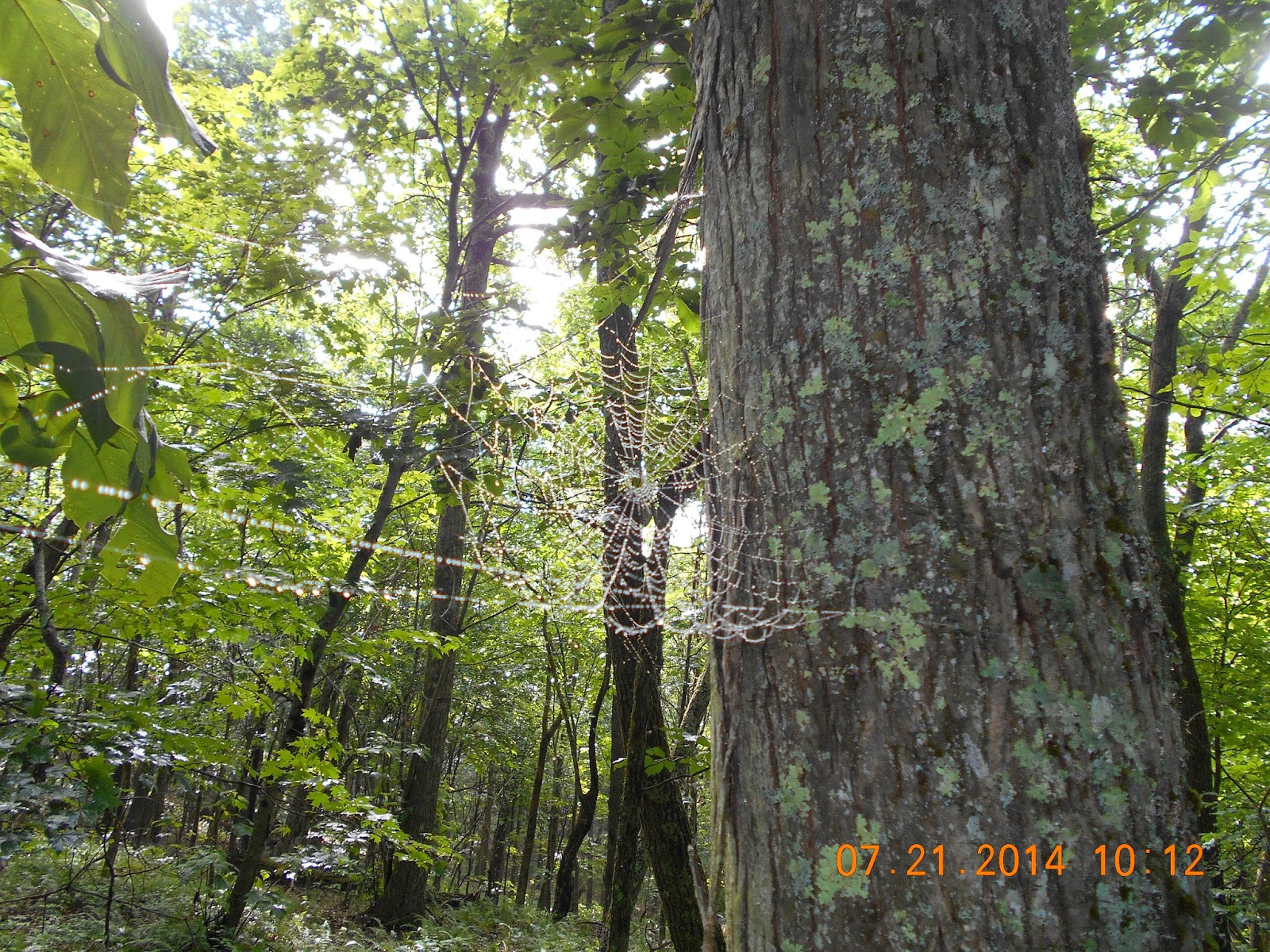
It was damp and foggy this morning, the spiderwebs were bejeweled with dew!!

-------------------------------------------------
Day 129, Tues 22 Jul, 672.4 miles

Start Laurel creek Shelter
End VA 630

Today was a resuply day, at Hwy 42 we hitched a ride into ,Newport, VA.  Just before 42, a family of beavers has dammed the little creek, resulting in a good size pond and flooded bog area.  Someone has been nice and put in some log boardwalks so hikers can cross the bog area dry.

Beaver Dam and resulting pond

The beaver house in the beaver pond

Hendo's Mom on the boardwalk through the bog

A Mr. Sarver stopped and picked us up and gave us a ride in to Newport.  Mr. Sarver stated that the shelter named Sarver Hollow we would be coming up to soon was named after his family who used to live in the area where the shelter is located.  Mr. Sarver dropped us off at the grocery store where we met Jill, James and Joe.  Jill graciously gave us a ride to the local restaurant Mikies 7th.  Jill even said she would check back at the grocery later to see if we needed a ride back to the trailhead...there are such nice people in the trail world.  We had a delicious lunch at Mikies 7th, the best burgers ever!!!  If you ever find yourself in Newport, VA you have to stop by Mikies 7th for a meal!!  Randy, a local mail-carrier ended up giving us a ride back to the trailhead.  Randy was even nice enough to take us by a local cocered bridge which was originally built in 1916.  It was great to see some local countryside and history.
1916 covered bridge

Mom washing out some clothes in the creek at our campsite for the night

--------------------
Day 130, Wed 23 Jul, 675.5

Start VA 630
End Sarver Hollow shelter

Hendo hugging Keffer Oak, largest tree on the AT in the south

Hendo next to Keffer Oak

I, Hendo, was not feeling well today and we had a crazy climb, that kicked my butt.  We stopped for a nap and met Rummy, a woman who thru-hiked the trail 2 years ago and was out for a 5 day section hike.  Rummy's hip was bothering her so she was going to stop at Sarver Hollow Shelter for the night and asked if we would like to join her.  Sarver Shelter if 0.4 miles off the trail, which is every unusual and considered too far for most of us, so there are few people that venture to shelters so far off the trail.  As a result, Rummy would probably be by herself unless we joined her.  Since water has been so scarce and I wasn't feeling well, mom and I decided to join Rummy at Sarver Shelter.  As expected we were the only three hikers at the shelter...therefore mom and I set up our tent screen inside the shelter and officially spent our first night in a shelter.  It turned out to be a good decision that we set up in the shelter, because it rained but since we were in the shelter our tent stayed dry and we didn't have to pack up or carry a wet tent.


--------------------
Day 131, Thur 24 Jul, 681.5 miles

Start sarver hollow shelter
End Niday Shelter

Hendo is feeling better today, but dislikes the Roanoke AT Club even more.  The hike from Sarver Shelter back UP to the trail is quite the hike at 0.4miles long, but it is at least fairly well maintained and nicely switchbacked.  Question is, why can't the AT itself be maintained and switchbacked just as well?

It rained on and off all day today, but we made it to Niday Shelter just in time before the thunderstorms moved in.  We saw our first bear today, a cub running home to its den to get out of the rain.  Mama bear was not in sight, so she must have been leading the way.

The AT ran along the Eastern Continental Divide for a while today

Hendo's Mom and Hendo at the Eastern Continental Divide

The trail ran along some rock outcroppings along the ridgeline today, luckily it wasn't raining during this half-mile section, as the rock can be very slippery when wet.

----------------------------
Day 132, Fri 25 Jul, 682.9 miles
Start Niday Shelter
End VA 621

After 3 days of getting rained on and 8 days since our last shower and laundry, we decided to seek some respite at the Four Pines Hotel.  It is a donation only hostel, so we we were able to pinch our pennies, but still have a dry place to stay.  We helped clean up around the hostel since we weren't able to pay as much as we would have liked to.


----------------------
Day 133, Sat 26 Jul, 689.3 miles
Start VA 621
End VA 624

Today was quite the day, hiking 15.4 miles and visiting the Audie Murphy Memorial and The Dragon's Tooth along the trail.

There was a bench along the trail up Brush Mountain on the way to Audie Murphy's Memorial.  Of course Hendo had to stop and use it.

Hendo at Audie Murphy's Memorial.  This is the Mountain which his airplane crashed into and he was killed.  It is a humble and amazing memorial with countless tokens of appreciation and honor.  I shared some of my Jack Daniels with him, a fitting tribute for such an American Hero.  In Iraq I had the honoring of supporting/serving with Audie Murphy's company, B Company, 1/15 th Infantry Regiment, 3rd Brigade, 3rd Infantry Division.

A 7th Special Forces Group hat is among the tokens of honor left at the Audie Murphy Memorial.


A look at Dragon's Tooth from Four Pines Hostel, rock monolith outcropping in left half of picture

Dragon' Tooth up close

Hendo's Mom climbing up on top of Dragon' Tooth.  Of course we climbed up on it

We both made it up...and eventually down, even though our technique left a lot to be desired

Hendo got "bit" by the Dragon's Tooth climbing up onto it.  She tore open an old airborne injury on her right elbow.  Guys dig scars though, right??

"Hiking" down the AT from Dragon's Tooth to VA 624, it was a challenging but fun section.  Whoever said Virginia was flat and fast was lying!!

Climbing down steel rungs in the rock face on the AT.

A warning sign at the bottom of the trail for dayhikers headed up to Dragon's Tooth.  There wasn't any warning sign for we thru-hikers on the topside.

--------------------

Day 134, Sun 27 Jul-zero

Day 135, Mon 28 jul - zero

Day 136, Tues 29 Jul- zero

--------------------
Day 137, Wed 30 jul, 708.6 miles
Start VA 624
End Campbell Shelter

700 miles!!!!!

Hendo and Hendo's Mom on the iconic McAfee Knob!!

Close-up of us on McAfee Knob

Representing for Jolly Rovers Trail Crew on Mcafee Knob


After hiking up to McAfee Knob, Hendo despises the Roanoke AT Club even more.  The trail to McAfee is a "four lane interstate".  Obviously all trail maintenance efforts are put into this 3.7 mile stretch ONLY.  As soon as you head over the mountain on north of McAfee it is obvious one is "on the other side of the tracks" or mountain.  And " the other side" isn't as worthy of trail maintenance as the ritzy dayhikers.  We are just disappointed and frustrated by the extreme difference in trail conditions between the dayhiker sections and the thru-hiker sections.

-------------------
Day 138, Thur 31 Jul, 714.6 miles
Start Campbell Shelter
End Lambert Meadow Shelter

Today we hiked over Tinker Cliffs, far more beautiful than McAfee Knob, but obviously not patronized by day-hikers as the trail up was without switchbacks, washed out and had lots of downed trees and limbs across it.
A cool tree growing around a boulder.

A hornets nest in the cool tree growing around the boulder.  We quickly and quietly hiked on after we saw it.

View from Tinker Cliffs looking back at McAfee Knob on right

Hendo relaxing on Tinker Cliffs

Hendo's Mom and Hendo on Tinker Cliffs

Hendo hiking along the trail on top of Tinker Cliffs

Mom hiking down along side Tinker Cliffs

------------------
Day 139, Fri 1 Aug, 724.0 miles
Start Lambert Meadow Shelter
End Daleville, VA

Today we headed into Daleville, VA to resupply, shower, do laundry, and buy mom some new shoes.  She has worn out her shoes with 624 miles on them.  The trail into town was like the rest has been, rocky and poorly maintained.


This section needs some help from the Jolly Rovers Trail Crew.  Notice the upside down bandana, a sign of distress.

Mom's worn out, "sewn up so she could make it town" shoes on the left. Her new bright yellow Vasques shoes on the right.  She was able to get them on sale, but were still a pretty penny.


Day 140-141, Sat 2 Aug-Sun 3 Aug
-zero daleville, laundry